
At the Colorado Department of Transportation, effective landscape architecture provides benefits beyond just a pretty view.
In fact, CDOT regards one of the major focuses of landscape architecture to be the “protection and enhancement of natural systems affected by the transportation system.”
To ensure this, the transportation agency recently issued the CDOT Landscape Architecture Manual (2014). The manual, which took about two years to write, brings together all information relevant to highway landscape design including aesthetic, sustainability, environmental, and landscape considerations.
 The intent of the manual is to ensure that federal and state requirements are addressed uniformly across the agency’s decentralized regions and the state’s diverse geography. “Transportation design is required to fit [in with] the existing physical environment using context sensitive design and practices,” according to Mike Banovich, a landscape architect who has been with CDOT for 25 years. Banovich said CDOT undertook creating the manual because it recognized the need to create guidance that would “improve program quality and compliance.”
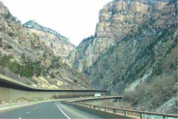
Focus on Context
The manual presents landscape architecture as a component of the entire planning and design process for transportation projects, using a multi-disciplinary approach. There is a “direct relationship” between design and place, the manual says.
With that in mind, the manual provides broad-ranging guidance on how to plan and design landscapes that appear natural, conserve water, protect resources, and are sustainable for the life of the road or highway.
The intent is to “expand transportation design decisions beyond strictly functional and engineering criteria within a Context Sensitive Solutions approach,” according to the manual.
Protecting vegetation, designing areas for new plantings, and controlling noxious weeds are key components of the landscape architect’s job and the manual discusses best practices and requirements under state and federal laws. Each of these tasks involves many variables, not the least of which are climate and geography.
Use of ‘Design Zones’
The identification of design zones is “critical to creating a relationship between transportation and landscape,” the manual said.
According to the manual, the state of Colorado encompasses five design zones:
- High Plains (east of Denver),
- Front Range Urban (Denver and its suburbs),
- Southern Rocky Mountain,
- Western Slope Basin, and
- Great San Luis Valley (at the border with New Mexico).
“By understanding the characteristics of each zone, CDOT can design unified corridors with consistency and a recognizable sense of place in each zone,” the manual said. For example, “the road alignment should respond to the dominant land form of a zone while the plant palette should be derived from plant species native to the zone and micro-climatic conditions. Details, such as colors and textures, applied to transportation facilities could be reflective of the cultural and landscape context.”
The design zones are consistent with the ecoregions described in the Federal Highway Administration’s Vegetation Management: An Ecoregional Approach handbook, issued in 2014. The handbook defines ecoregions as areas of similar geographic, vegetative, hydrologic, and climatic characteristics, and emphasizes the use of native plants along roadsides to reduce maintenance costs, provide better erosion control, and create ecological diversity.
Native Plants a Requirement
At CDOT, a nearly four-decade-old policy requires department personnel and contractors to use native or dryland adaptable plants on all landscaping projects. To implement that policy, the manual directs landscape architects to preserve or salvage existing vegetation in the project area. If that is not practical, the area must be replanted with native species and must follow the principles of xeriscaping, a technique that reduces or eliminates the need for irrigation.
“Xeriscaping is very important [at CDOT] because Colorado is primarily a semi-arid cold desert experiencing drought and extreme weather fluctuations,” Banovich said. “CDOT’s objective is to use native plants adapted to our arid climate in non-irrigated conditions.”
Additionally, the manual directs that existing topsoil must be preserved and reused, which includes stockpiling during the construction phases of projects. Topsoil can be imported from elsewhere only as a last resort.
Threats from Invasive Species
Like many states, Colorado faces threats from invasive plant species that diminish the value of cropland, rangelands, and native habitat. The state has enacted legislation that identifies noxious weeds that are to be contained, controlled, or eliminated. Also, state law for the protection of stream-related fish and wildlife requires the department to consider noxious weed eradication while planning for construction projects in riparian zones, according to the manual. Additionally, construction equipment and stockpiled topsoil must be kept free of invasive weeds.
Vegetation planted or maintained in highway rights-of-way must not create unsafe conditions for drivers and vehicles. The manual discusses the importance of maintaining sight distances for drivers, having trees and other large plantings set back from the roadway, and avoiding conditions where too much shade can cause visual hazards or allow ice to form on road surfaces. Additionally, newly constructed features in rights-of-way should include landscape designs that minimize rainwater runoff and the need to irrigate.
Role of the DOT Landscape Architect
In addition to laying out the standards and best practices, the manual provides information on the role of the landscape architect in the transportation department. The landscape architect is a valuable participant in projects from the early planning stages through the National Environmental Policy Act (NEPA) process and even after completion, according to the manual. Many state departments of transportation such as CDOT have landscape architects on staff.
The landscape architect’s role is “to act as the design liaison between environmental specialists and engineers…by incorporating environmental needs and requirements into the project objectives,” Banovich said. Additionally, stormwater management and water quality have “become important components” of the landscape architect’s job in recent years, Banovich said.
According to the manual, planting design concepts are a result of the landscape architect’s training in elements such as color, form, line and texture. The placements of plantings on the highway right of way serve to:
- Protect against erosion.
- Minimize water use through the use of native drought tolerant species, mulches, and the use of irrigation systems designed for low precipitation systems.
- Promote stormwater reduction runoff practices via interception and root infiltration.
- Screen undesirable views from the highway and screen highway from adjacent land owners.
- Guide traffic.
- Avoid root or foliage contact from deicers.
- Minimize maintenance requirements.
- Provide shade at scenic overlooks or at rest areas.
- Frame and emphasize a view.
- Screen highlight glare.
- Mitigate impacts to surrounding communities.
- Reduce driver monotony.
- Provide wildlife habitat.
- Salvage, protect or reuse existing vegetation, when possible.
- Mitigate for wetland/riparian impacts.
Lessons Learned
For other DOTs considering creating their own landscape architecture manual, Banovich suggests obtaining “concurrence from DOT leadership” while also involving environmental resource specialists.
Additionally, it is important to “define the use of the manual in a policy objective which in turn will justify the use of the manual” as a part of the DOT’s operational procedures, Banovich said.
For more information, contact Mike Banovich, RLA, CDOT Ecological Design Unit Manager, at [email protected].