
The Utah Department of Transportation (UDOT) has developed a powerful interactive planning tool, UPlan , that provides a comprehensive data repository where users from state, local, and federal agencies and the public can share data. With this wealth of information in hand, transportation planners, as one of many user groups, can make more informed, strategic decisions that reflect a broad understanding of the potential impacts each project may have, including its environmental impacts.
“UPlan gets everyone on the same page,” said Becky Hjelm, GIS Manager at UDOT. “It’s a visual tool that connects our users to current, relevant business systems and data sets within UPlan as well as data sets outside it.”
UPlan data takes the form of hundreds of dynamic GIS web maps and apps that incorporate information from multiple datasets. For instance, transportation planners interested in environmental links to a project can simultaneously view the locations of critical environmental attributes such as streams, wetlands, rare plant habitats, and historic sites, along with maps of planned transportation projects scheduled to be carried out in the same geographic area. Users can search for data in a variety of ways.
Diverse Users
Currently, according to Hjelm, there are approximately 100 UPlan users who actively are creating content, And there are hundreds more who come to Uplan for the information they need. Users include representatives from transportation agencies, resource agencies, metropolitan planning organizations, local governments, citizen groups, and the public. A very small percentage of the data in UPlan is sensitive. Access is to sensitive data is handled in two ways, 1) by providing secure access via a login; and 2) an MOU with the responsible agency defining acceptable use. One way around the sensitive data concern is to provide what is called a buffer data set, which provides general but not precise locations.
Hjelm said one positive outcome of UDOT’s investment in web GIS development is the Utah Mapping and Information Partnership (UMIP), a coalition of Utah state agencies that includes the Department of Environmental Quality, UDOT, the Department of Public Safety, and other agencies, as well as a handful of Utah counties.
UPlan originated in 2008 when UDOT planners and engineers realized that they were spending inordinate amounts of time looking for data that was in silos and scattered across agencies. They decided that it would be well worth investing time and money to create a single location where relevant data from a wide variety of sources could be gathered and housed for convenient access.
In 2011, UDOT applied to AASHTO’s Technology Implementation Group and UPlan was accepted as a Focus Technology within its Innovation Initiative. Since then, the UPlan model has been piloted in 39 states, and a number of them have developed, or are in the process of developing, their own state-specific version of the repository.
One of the strongest benefits of UPlan, says Hjelm, is that it opens up opportunities for collaboration that did not easily exist in the past. By sharing information with partner agencies and stakeholders early in the planning process, transparency is created that can foster greater trust across agencies. It also creates conditions in which more efficient, effective, and sustainable approaches to projects can be identified.
uPEL Report
One of UPlan’s most useful applications has been its ability to identify potential environmental impacts of projects and generate what is called Utah’s Planning and Environment Linkages Report (PEL) (uPEL report). Each report summarizes all of the environmental and community resources that are intersected by a potential project’s footprint. Resource information on nearly 20 topics can be drawn upon for the analysis, such as floodplains, rare plants, Section 4(f) lands, environmental justice concerns, and historic sites. An accompanying factsheet with each report provides information related to the project needs, forecasts, conditions, and other current and planned work in the area. More information about uPEL can be found in the uPEL User Guide
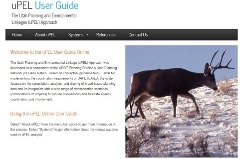
Utah DOT’s uPEL User’s Guide helps link planning and environmental decisions. Source: UDOT
Underlying each uPEL report are the collaboration and integration principles that form the basis for FHWA’s Planning and Environmental Linkages (PEL) approach to transportation decision-making. Using the approach means 1) considering environmental, community, and economic goals early in the transportation planning process; and 2) using the information, analysis, and products developed during planning to inform the environmental review process.
Hjelm cited several examples in which uPlan and uPEL have been used to great benefit. The first was the Uinta Basin Rail project in which it was used to screen 26 possible alternatives for laying approximately 4500 miles of track. What normally would have taken a few years of investigation was achieved in a few months.
In another case, uPEL was used to support analysis for a Programmatic Biological Assessment (BA) for the Utah prairie dog. UDOT conducted a GIS analysis to identify locations where Utah prairie dog habitat intersected highways using UPLAN and uPEL. Then, UDOT and the U.S. Fish and Wildlife Service conducted one single Section 7 consultation that cleared an entire sub-set of projects for a 20-year period. The Programmatic BA enabled UDOT to streamline compliance with the Endangered Species Act while helping to ensure conservation of the Utah prairie dog.
Continuous Improvement
Hjelm said that although uPEL in its current form definitely has proven its worth, UDOT is planning to overhaul the application in several significant ways. First, the format of uPEL reports is being revised so that the information can be dropped more easily into required documentation for National Environmental Policy Act compliance. In addition, changes are being made that reflect changes in the system’s data sets.
In addition, the current online User Guide is being revised to make the information more easily understood and include lessons learned. The guide explains how uPEL works, how reports are generated, and the benefits of using it as a planning tool. It also contains sections on each environmental system included in the repository (e.g., floodplains) and describes how transportation projects can affect that system, repercussions if that is the case, datasets about the system that are included in the repository, and contacts for more information.
Code Available to Other States
Hjelm said the code behind UDOT’s uPEL is being offered free to other state DOTs who are interested in creating their own PEL-type application. Although they will have to invest considerable time modifying the framework and populating it with data to fit their needs, obtaining the code “should provide a starting point.” Several other states have, or are developing, tools that are similar to uPEL, she said. Each state will have its own challenges with data sharing.
Her primary advice to other state DOTs who may be contemplating a PEL-based tool: Be bold in your thinking and be patient with the process. Sharing data and building constructive relationships with other agencies and citizen organizations sometimes can take time. But the time invested, especially at the beginning of the process, is well worth the effort over the longer term.
UPlan and uPEL will continue to evolve to reflect constantly changing circumstances, she adds. One option UDOT is exploring is the possibility of incorporating 3-D maps. The ultimate goal is to have information flow seamlessly across multiple disciplines including engineering, design, construction, operations, maintenance, and environment.
For more information, contact Becky Hjelm, GIS Manager, UDOT, at [email protected], or visit the UPlan website.